- GPS Precision Navigation
- 1 (800) 99-AGNAV


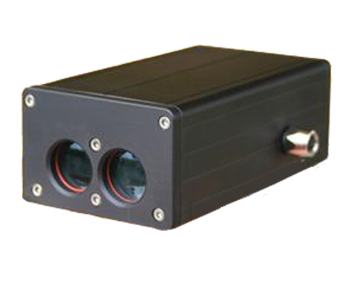
AgLaser Altimeter
AIRCRAFT LASER ALTIMETER
The AgLaser is a device manufactured by AgLasers, LLC used to measure aircraft's height above ground
Accuracy
The AgLaser uses infrared technology to give you a highly accurate reading on aircraft's altitude above ground or canopy. It offers a high range from 0-150m (500ft). Altitude information can be used for altitude guidance, spray height in drift offset calculations, and more
Guia Compatible
Keeping track of the height is crucial for aerial applications, which is why the AgLaser is fully compatible with the Guia navigation system. Guia displays the altitude on screen and/or on the lightbar, and logs altitude together with other flight and application data.